The Meetjesland in the north of East-Flanders, Belgium
Bentille, een Meetjeslands dorp
Long ago in the years 1375-76 due to one of the many inundations the people of St.-Jan-in-Eremo were forced to move to higher ground. They moved to Bentille which became a hamlet of St.-Jan-in-Eremo.
Bentille a hamlet of St.-Jan ? This statement infuriates some of the natives of Bentille. They claim it's the other way round because Bentille has a much larger population than St.-Jan.
The etymology of Bentille ? Jordy Haverbeke says "bent" is short for bentgras, in English "bentgrass" en "ille" from "hil", in English hill. It's not certain there was a real hill but this region here was raised above the rest of the area.
 
|
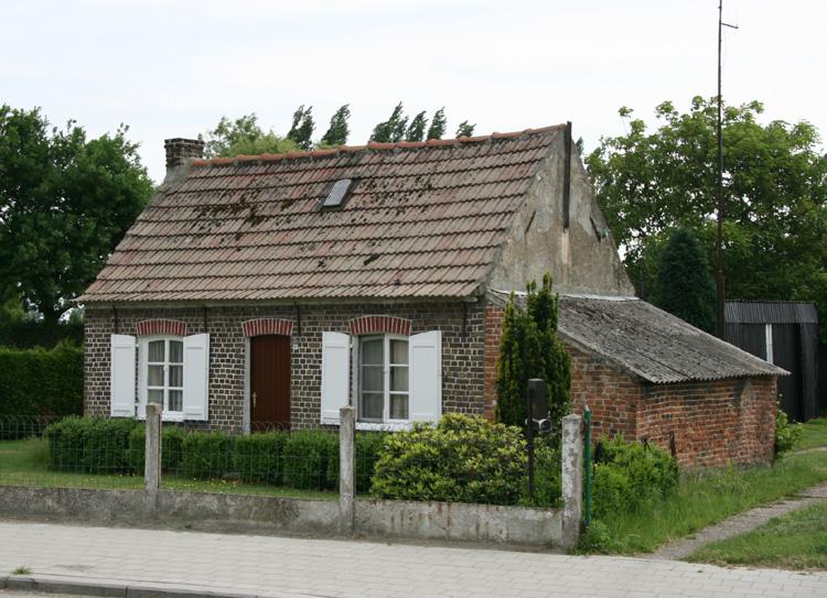
This picture was taken on 24 May 2008.
In the meantime the church of St-John the Baptist in St.-Jan, much smaller than Bentille's, has been downgraded to a chapel.
And the church of Bentille ? Many years ago we wrote: when you step
inside Bentille's beautiful church you step into a haven of peace and serenity as
these pictures attempt to show.
In 2017 this beautiful church became a... gymn—for the kids of the school next
door.
We don't know a lot more about the history of Bentille or the origin of its name. All help you may be able to give will be gratefully accepted. If you have read some of our others stories on this Meetjesland website you know what we're looking for.
In the meantime we put up some pictures here.
 Until about 1975 the flax industry was very important for the region.
The flax had to be steeped in water to separate the outer skin of the stalks
from the long fibres that were used to make textiles. The fourth picture
above shows one of those pits where this steeping took place. Those pits
that still remain now lay idle and worthless.
Bentille and Sint-Jan-in-Eremo together
formed one separate town until 1977. Both together are 1,260 hectares
(3,112 acres). In 1977 they were merged with
Watervliet,
St. Margriete,
Waterland-Oudeman and
St.-Laureins into what we call here Greater
St.-Laureins. On 1/1/2004 the population of both towns together was 1,048.
And exactly one year later it stood at 1,039 according to the official
Greater St.-Laureins website.

More pictures
Our Meetjesland
— Table of Contents
— Find something in this Meetjesland website

MijnPlatteLand.com
Most recent update : 05-03-2023
Copyright Notice (c) 2026


